A Suburb that Puts People First

One of the biggest demerits of suburban living is how they can have an isolating effect on people who live in them. When most suburbanites leave home, they enter a car that’s usually in an enclosed garage where you often drive to another garage at work or the store or wherever. In cities where garages are less common, you leave your home and you’re thrust into contact with your fellow human. We’ve looked at Pocket Communities before, which are communities of single family houses where the front door faces a commons area, fostering a more social living environment. And we just ran across this new suburban development in Mannheim, Germany that puts the humans first in its design. The development, which has many of the hallmarks of suburbia like single family homes and yards, has two notable things missing: cars and parking.

mvrdv-grid

Johannes Pilz, one of the architects behind the project told FastCo.Exist:

By getting rid of the cars, you then open up the streets, whether it’s for children to come out and play with each other, or to encourage residents to sit outside their house, chat with one another, or go for a stroll…By getting rid of the [pavement] barrier between households, you then increase interactions between neighbors, and the community then starts to bond.

The lead developer, MVRDV, specializes in affordable housing. The development is designed to avoid gentrification by creating a diversity of housing types as well as taking a modular approach to construction. Residents will be given a catalog of houses to choose from of various sizes, heights, etc. Instead of each house representing a custom design, many are reconfigurations of basic building blocks, streamlining design and construction processes and cutting costs.

MVRDV-housing-types

The development, which will be built on an old US Army barrack, is also next to a tram stop, so people who commute into the city could live car free if they so chose. There will be underground parking available however, for residents who want a car and for emergency vehicle access.

MVRDV-Courtyard

Some of the promises of suburban life are safety and community, but because many suburban developments design more around cars than people, those ends are often not achieved. The design of this development shows what can happen when people come first, and  we think it looks pretty great.

Via FastCo.Exist

The Problem(s) with Tiny Houses

At LifeEdited, we love tiny houses! They are like architectural and existential reduction sauce. Every space and object that isn’t utterly essential, that isn’t something you absolutely need, is boiled away. They are great examples of how humans can live simpler, lower impact lives. Yet tiny houses have some big problems, ones that are often overlooked amidst the hype, and it’s not just their lack of legality.

The biggest problem with tiny houses stems from density, or lack thereof. At their core, tiny houses are small single family homes. As Kriston Capps wrote in CityLab a couple years ago, tiny house enthusiasts “are confirming the status quo, if shrinking it a little.” All single family homes, huge or tiny, require their own lot and almost invariably take up more space than multistory, multifamily housing. Individual lots lead to reduced density which leads to greater land use and increased transportation needs (aka sprawl). To build density, the best strategy is often to build up rather than out.

Here’s an absurd example to demonstrate this point. One57 is a building in Manhattan often called “The Billionaires Building.” It is the epitome of excess. One of its penthouses fetched over $100M and the average per square foot purchase cost is about $6K. But the building’s 94 units and 75 stories (some of those units are as big as 11K sq ft) sit on a 23,808 sq ft lot. This means that each unit takes up 253 sq ft of ground space…oh, and there’s a 210 room hotel on its lower floors.

Now compare that to a normal tiny house on wheels. An average tiny house is about 200 square feet. Add a very modest 10 ft of setback on each side and you’ll need a 1K sq ft lot. Just to be generous, we’ll say that a car can fit within that lot, but realistically you’ll need additional room for parking. 1K ft is still considerably smaller than the average single family house lot which is 15,456 sq ft, but quite a bit more than the humble One57.

Speaking of cars, whenever you see a tiny house out in the country, you have to wonder: how do residents get to and from their houses? How do they get their food? In most instances, they drive there. And as we know, transportation is one of the (if not the) biggest factor in increasing a home’s carbon footprint. Meanwhile, the residents of One57 can walk to get everything they need and are spitting distance from several major subway lines (One57 residents are more likely to spit on the subway riders than ride the subway, but that’s a separate point).

Then there are access issues. We ran across an article singing the praises of tiny houses as retirement homes. While a nice idea, most tiny house designs are a poor fit for seniors. Sleeping lofts are difficult and hazardous to access. And try fitting a walker into a tiny house bathroom. And single family housing tends to be more isolated, which is not ideal for seniors. Meanwhile, One57 has commodious bed and bathrooms and lounges and spas where you can discuss with the hassles related to the Panama Papers with your peers.   

Of course there are many asterisks to the above arguments.

  • One57 is only dense because it bought the air rights of surrounding buildings, thereby reducing the housing density of nearby buildings. And to suggest that someone living in One57 has a smaller carbon footprint than someone living in a tiny house (no matter the location) is patently absurd. A better comparison would be someone living in a normal-sized 5-10 story multifamily building in a walkable location.
  • If you live fully or partially off grid and grow much of your own food and don’t drive much or at all–a not too uncommon scenario for tiny house dwellers–you can significantly reduce your environmental impact. The non-consumer-fueled lifestyles of most tiny house dwellers should also be factored in (though you could live this way in an apartment as well). 
  • There are many tiny houses that are being clustered as communities or being used as ADUs in low density areas, making those areas more efficient.
  • And while tiny houses might not be great for most seniors, they’re fine and dandy for millions of other people.

The main point is that a home’s impact cannot be assessed without considering its context, and in general the context that’s going to make a home lower impact is locating it in a central location. And the way to build more units centrally is building modest (they need not be tiny) multistory, multifamily housing. Condos and apartments might not be as photogenic as tiny houses, but they get the job done. 

The last point, lest you think we’re hating too much on tiny houses, is that it’s not an either/or situation. As Shaunacy Ferro eloquently put it in FastCo.Design:

Just because micro-units are badly needed in urban areas doesn’t mean small-scale dwellings should be restricted to tiny apartments in big cities. New zoning laws in Portland, Oregon, encouraging the construction of granny flats is still adding density and creating more affordable housing options, albeit not to the same extent as San Francisco’s 300-square-foot units. Nor are micro-houses on large plots of land without benefit. Precious though a beautifully designed tiny house in the midst of the wilderness may look, it’s a better environmental choice than building a McMansion. Shrinking the status quo isn’t that bad of an idea.

The Oracle of Awesome, Affordable, Urban Living

There’s an ideal we promote on this site about the perfect edited life. Here’s how it goes: live in compact apartment without much stuff in walkable, culturally vibrant city. Work and friends are just a quick walk/bike/subway ride away. Because your home is smaller, you don’t accumulate a bunch of useless stuff and there’s less to take care of, allowing you to pay attention to relationships and experiences. This way of life is greener and more fulfilling than living in a big suburban home on a cul du sac. But here’s the rub: the cities we tend to associate with walkability and vibrant cultural scenes–NYC, SF, Boston, Toronto, Vancouver and a handful of others–are, for a variety of reasons, batshit expensive. The simple, edited life becomes difficult to achieve for many because they must struggle to just get by, even if they’re living in the tiniest of apartments with nary an extraneous personal possession. This grinding way of life can make people question whether the edited life in these cities even exists. But before you ditch your walking shoes for an SUV and your apartment for a McMansion, you should consult Johnny Sanphillippo.

Sanphillippo describes himself as a housekeeper, gardener and handyman by trade, but he is more of an oracle. For the last few decades, Sanphillippo has seen where things are going in terms of lifestyle and real estate trends before they happen. Despite the fact that he’s hardly made more than $20K a year for much of his life, Sanphillippo has been able to purchase homes in San Fran’s Mission District (as part of a group), Sonoma and Hawaii. When he purchased these places, they weren’t the real estate golden children they are now (with the possible exception of Hawaii). Sanphillippo saw their good bones of these places–whether it was culture or walkability or lovely weather–and invested accordingly. This prescience is why Sanphillippo latest real estate investment in Cincinnati is so interesting.

over-the-rhine

“I think of the big cities like New York and San Francisco being like a balloon,” he told me. “When you squeeze one part of the balloon, another part bulges. So if a bunch of people grab at the middle of New York or Toronto or San Francisco, it’ll push other people to edge. The problem right now is that everyone is trying to grab hold of every part of the balloon and a lot of people are seeing that they just can’t make it work.”

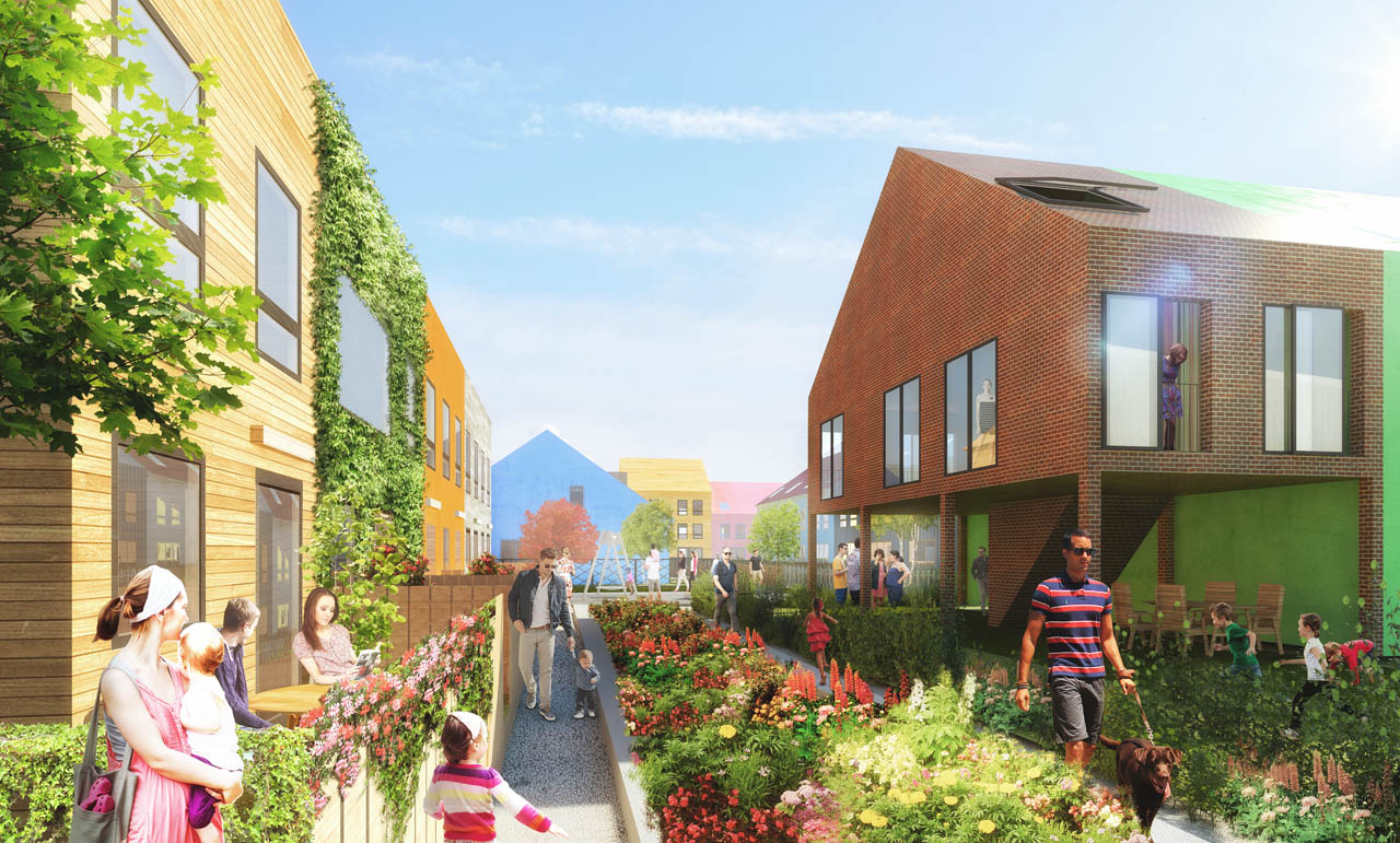
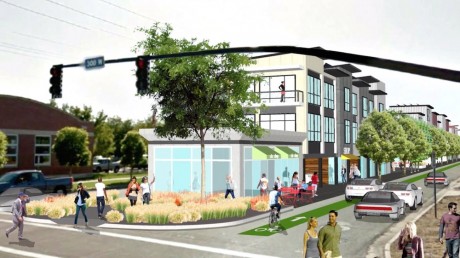
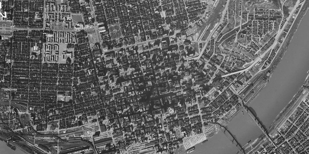
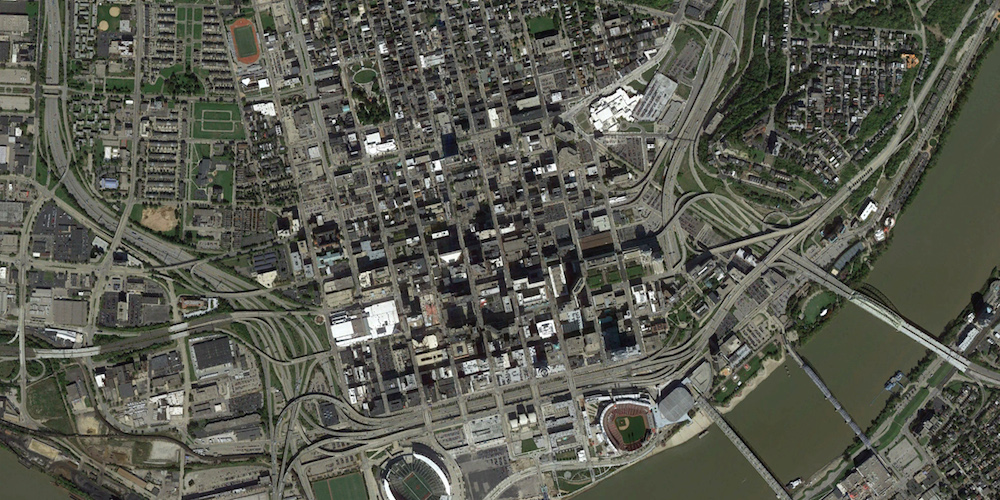
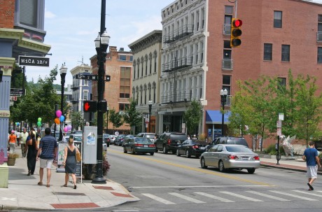
But he says this squeeze is not the case in second and third tier cities like Cincinnati, Pittsburgh, Louisville, KY, Philly and others that are not the darlings of the monied few. Despite their lack of glitz and glamor, he believes that these cities are very livable and attractive and that many people are realizing this. Because they were developed before the car, they offer walkable streets lined with solid, beautiful old architectural. Most importantly, their real estate values are approachable for people making normal salaries.

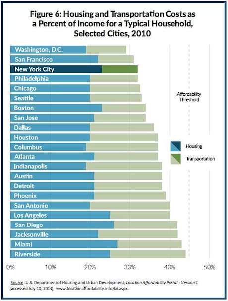
“If you want to stay in the New York area and want something a little bigger and more affordable than what you can get in the city, you’ll probably end up in some split level ranch house in Long Island far from everything.” Alternatively you could live in one of these second or third tier cities, which offer many of the benefits of a New York at a fraction of the price. He says that many people who initially bristled at the idea of living in a place like Cincinnati begin to see its merits after some analysis–they see the walkability, safety, affordability and human scale. “Sure, you might not have access to same super fabulous jobs as New York, but let’s face it, most people have normal jobs,” he says.

The changes in today’s workforce is one reason why these and other cities are becoming more economically viable. Many of today’s workers just need a strong wifi signal and access to a major airport to conduct business, leaving them free to live where they want. He also cautions that the super fabulous jobs in New York and San Fran–and their attendant extreme housing costs–might not always be there. If there are crashes (or adjustments) in the financial and/or tech industries respectively, the solidity of those cities’ economy might be quickly dissolved.

streetcar-suburbs

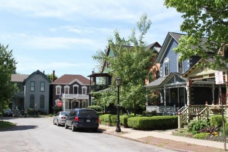
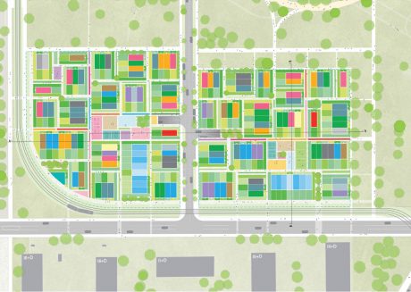
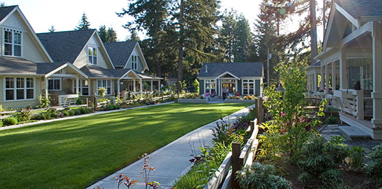
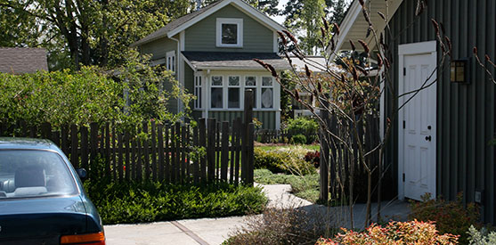
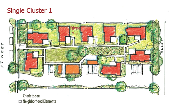
Sanphillippo presents options aside from the city centers. There are “streetcar suburbs”–areas developed between 1890-1940 that might lack the higher density of living in a city center, yet still offer compact, convenient living. He said you might not be able walk everywhere or live without a car in these places, but you might be able to go from four cars for a family to one.

He also said that people can “retrofit suburbs,” creating pockets of density in suburban enclaves, ideally with groups of other like minded folks. He says this is easiest to do in suburbs developed in 50s and 60s when car ownership was not a given for every adult. In fact, most of Sanphillippo’s top picks for places to live are inversely related to car-dependency. He said this retrofit process is not an overnight process. “It took 60 plus years to get to car dependency and it could take another 60 years to get to something else.”

If you’re looking for great places to live–or simply a fascinating blog–Check out Sanphillippo’s Granola Shotgun, where he tours the country looking for what’s next, taking pictures, talking to locals and presenting myriad options for living an affordable, urban life.

image via Urbancincy

Our House In the Middle of the Street

If you have ever visited Salt Lake City or other cities settled by Mormons, you might have noticed unusually wide streets. The reason is that their grids were based on an agricultural utopian plan devised by Joseph Smith and Brigham Young. The plan decreed that every street be wide enough for a loaded ox cart to flip a uey; this translates to at least four modern lanes (and often more) with widths ranging from 66 to 172 ft. While this bit of urban planning might have been great for ox-cart drivers and those they served (both constituencies having passed 100+ years ago), it didn’t lay the foundations for dense, walkable city centers. An organization called The Kentlands Initiative is proposing to find new uses for these wide lanes, adding housing and commerce to the medians of SLC’s commodious streets.

granary-row

Kentlands already set up a successful popup installation called Granary Row. It featured a shipping-container housed beer garden and various shops plopped in the median of a sleepy stretch of road. They are now trying to obtain a 99 year lease for the land, facilitating more permanent structures.

granery-beforegranery-after

The concept, while a bit unorthodox, is kind of hard to argue with. First, they’re not eliminating any thoroughfares–merely trimming them to a size that’s proportionate to traffic to their existing traffic. Secondly, since the city owns the streets, they would be the leaseholder and directly benefit from the plan.

Via Gizmodo

The Neighborhood within the Neighborhood

Pocket neighborhoods prove that an edited home can take on many shapes and sizes and be located most anywhere. The term, coined by architect Ross Chapin, refers to clusters of houses that share common, car-free outdoor areas like gardens, joined backyards and even alleyways. The idea is to design the conditions that promote tight-knit communities–where neighbors look out for one another, where children can play safely, where it’s not a big deal to ask someone to walk your dog or borrow a cup of sugar.

In a smart move, pocket neighborhoods are designed to promote community but also have enough autonomy and privacy for members to do their own thing. One particular design flourish that supports this is the orientation of the houses. By nesting the houses–i.e. the ‘open’ part of one house like its entrance faces the ‘closed’ part of another like its side or back–separation is created without a big yard. Strategic use of low fences and perennials create further barriers for the tightly spaced houses.

Pocket neighborhood houses need not be new and they can be any style, as indicated on PN’s website:

Residences in a pocket neighborhood can be any style — Craftsman Cottage, Contemporary, Spanish Mission, Screaming Solar or Modern Modular. They can be detached single-family houses, attached townhouses, or clusters of urban apartments. The key idea is that a limited number of nearby neighbors gather around a shared commons that they all care for. There are a number of design principles that make pocket neighborhoods successful, but style is not one of them.

Those design principles include a cap on the number of houses in the neighborhood (12 max, but multiple clusters can be joined by walkways), no cars or traffic in the commons, no parking in front of the houses and the active rooms like porches should face the common spaces.

While there are a number of pocket neighborhoods with larger houses, Ross Chapin Architects (RCA) seems to promote “cottage style houses” as the optimal house-style for the neighborhoods. The PN site explains why:

If houses are too large, residents tend to spend all their time indoors. With slightly snug houses, the porch, gardens and shared common buildings get used more, which fosters connection among neighbors. As well, a house that is ‘not so big’ is more likely to be fully lived in and cared for.

These cottages are less than 1000 sq ft and include design elements like large windows and built-in cabinetry that make the space feel larger and use every square inch of space to its fullest capacity. This layout of multiple small homes clustered together reminds us of the upcoming Napoleon Complex by Four Lights.

So far RCA has helped build 14 pocket neighborhoods in the northwest. They take pains to say they are an architecture firm, not a developer, and that there are numerous zoning issues that make establishing a pocket neighborhood difficult in certain areas. They have resources for developers and a book if you’re interested in establishing a pocket community of your own.

We see the pocket neighborhood as a great option for establishing a strong community while using minimal resources and being adaptable to environments ranging from urban to rural.

Do you have firsthand experience with pocket neighborhoods or similar communities? If so, let us know your thoughts in our comments section.

images via Pocket neighborhoods

This post was originally published May 20, 2013 and has been updated slightly. 

Where The Streets Have No Cars

It’s funny how transparent cars are in today’s cityscapes. They’re a given and just blend into our field of vision. But what if every car on our streets disappeared? What would those streets look like? How could we use them differently? That was the query one South Korean neighborhood asked as well as the challenge it took on. In 2013, as part of EcoMobility Festival, Haenggung-dong, a neighborhood of Suwon, blocked 1,500 registered cars from its city for one month. Residents were asked to walk, bike, take public transit or car-share instead. The experiment was the subject of a recently released book, Neighborhood in Motion: One Neighborhood, One Month, No Cars.

Neighborhood-in-Motion-2-800x533

The festival and experiment were designed to get people familiar with a future with scarce resources. The book goes into every aspect of the project–from finding a city wacky enough to try such a bold experiment to its aftermath. From a review of the book in Pop-Up City:

The book intriguingly shows how an urban district changes within the car-free month: from busy, car-oriented streets to a more attractive neighborhood that offers a higher quality of life due to less smog and more possibilities to use public spaces. Cafés were able to extend their seating onto the sidewalk, children were able to play in the streets safely and people started to play nightly games of badminton in the streets.

Sounds good to us.

The 2015 EcoMobility Festival will be in the Sandton neighborhood of Johannesburg, South Africa–an area where not everyone is on board with ditching their cars for a month. What’s great about the festival is that overcoming protests, and perhaps winning over some hearts and minds in the meantime, is far more feasible for 30 days than forever.

Via Pop-Up City

The Slow Death of the Walkable City

As a bit of an urban planning enthusiast, I’ve often wondered how cities that predate widespread car-ownership can be so car-dependent nowadays. For example, I am from Chicago, a city that was booming well before the Model T hit the assembly line. Yet today, there are large swaths of the city that are, for all intents and purposes, inaccessible without a car or a ton of patience for public transit.

The fact is most cities that predate ubiquitous car-ownership were far more walk/bike/public-transit friendly than they are now. Their cityscapes were characterized by dense housing on small lots connected by narrow streets. People walked, biked, rode horses or took streetcars to get where they were going. Without cars, people had to live close to their work, stores, etc.

In the mid 20th century, much of this density was lost to make way for the car, a fact illustrated so well by these maps published by the University of Oklahoma’s Shane Hampton. He writes of the contrasting views:

60 years has made a big difference in the urban form of American cities. The most rapid change occurred during the mid-century urban renewal period that cleared large tracts of urban land for new highways, parking, and public facilities or housing projects. Fine-grained networks of streets and buildings on small lots were replaced with superblocks and megastructures. While the period did make way for impressive new projects in many cities, many of the scars are still unhealed.

Indeed, the pictures show cities eviscerated by highways. Semi-occupied lots fill the spaces where tightly packed housing once stood. Wide arterial roads replace narrow streets. It is a picture of sprawl.

What’s interesting is that many of the cities featured have experienced economic decline in the last 60 years. On the other hand, cities like San Francisco, Boston and New York City that did not undergo such profound transformations (not that people didn’t try), have remained economically vital.

As with many things, the answers to present and future problems can often be found in the past. The older pictures show that we know what to do, how to build and how to make cities vibrant, walkable and sustainable. If we can build that type of cities once, we can do it again…at least one can hope.

See more interactive maps on the University of Oklahoma’s Institute for Quality Communities website

Hat tip to Lloyd

In Praise of the Mobile Home Park (Don’t Call it a You Know What)

A recent NY Times article centered around Montauk Shores, a mobile home park on the far east end of Long Island, NY. Whereas many mobile home parks are paragons of low-cost living, Montauk Shores, with its prime location in the Hamptons, on a bluff overlooking the Atlantic, has 2K sq ft trailer lots fetching as much as $1.1M. These kind of sums are not unprecedented for mobile home lots. Paradise Cove in Malibu is a celebrity-studded mobile home park where homes and their lots frequently sell for north of a million dollars.

These stereotype-defying sums for sheet-metal-sided mobile homes seem to evidence the adage “location, location, location.” But there might be something more to the charms to mobile home park living than proximity to the beach. In every account of Montauk Shores and Paradise Cove, there is talk about community. The Times says of Montauk Shores, “Everybody knows everybody through barbecues and drinks on the decks, the children roam the dunes and ride bikes unsupervised, and the beach is a few steps away.” At Paradise Cove, Director Tom Shadyac reports that it takes 20 minutes to take his trash out because he’s always chatting with neighbors. The reason for these tight communities may be more than idyllic settings (though that is surely one reason). The tight community connections may be related to the tight-knit, human-friendly zoning mobile home parks enjoy.

In many ways, mobile home park zoning and architecture gets right what conventional zoning and architecture does not. Rather than separating people like traditional suburban zoning does, mobile homes bring people together. Rather than having arbitrary minimum building sizes like many suburban homes, mobile homes allow for compact–not tiny–and efficient architecture.

We were tipped off recently to a story by Charlie Gardner in the Old Urbanist blog that demonstrate the potential for creating high-density, human-friendly housing via mobile home parks. Gardner takes a mobile home park in Bradenton, Florida as an example.

Bradenton_zoning

The chart above shows the respective zoning requirements for R-1 (single-family house), R-2 (two-family), R-3 (multi-family), R-4 (mobile home) and UV (Urban Village, a seldom-used designation). Gardner spells out the implications of this nicely:

Note that in the mobile home district, minimum lot sizes are less than half that required in the single-family district, even though both only permit single-family homes! The comparative minimum dwelling sizes are a strikingly divergent 1,500 sq. ft. and 400 sq. ft. The mobile home zone is allowed to be built so densely, in fact, that its maximum permitted units/acre is equivalent to the multifamily zone. Not shown here are the parking tables, which require only one space for mobile homes, yet two for single-family homes, regardless of square footage.

Also worth noting are the respective setback distances. A setback is the required distance from home to its lot’s border, and it’s a prime culprit of creating sprawl. Single family homes require 20′ of setback in both front and back; for mobile homes it’s 5′. The image below shows an aerial view of R-1 and R-4 neighborhoods and illustrates how the minimal setbacks and lot size affect overall density.

mobile-home-park-overhead

Gardner explains that one of the reasons mobile home parks enjoy this type of flexible zoning is their history as a more transient form of housing. Gardner speculates that regulators saw mobile home sites “more as parking lots than as a formal arrangement of streets and building lots,” and thus didn’t impose all of the restrictions they did for site-built, single-family housing.

One hurdle of the mobile home park is architectural. Mobile homes have standard dimensions; single-wides are 18′ (5.5 m) or less in width and 90′ (27 m) or less. R-4 zoning is designed around these dimensions and parks like the one Bradenton are required to use mobile homes rather than site-built housing. Mobile homes are historically poorer quality than site-built housing. This author actually lived in a mobile home for a couple years and the house itself was pretty flimsy in all the ways you would guess. The ability to put site-built or sophisticated mobile home architecture in mobile home parks would be a huge step toward creating sensible, detached, single-family housing.

While mobile home parks are not a panacea for the world’s housing woes, they do present one compelling model for the future, where housing is built sensibly and with community formation in mind. These are both good things. It’s probably about time conventional architecture and zoning starts veering away from constructing figurative castles with their large moats.

Thanks for the tip Tim!

Images and content via Old Urbanist blog

Why Living in New York and San Fran is Affordable

It’s fair to say that New York City and San Francisco are the darlings of dense, walkable urban living in the US. It’s also fair to say that rents and house prices in those cities are bat-sh#t crazy expensive; median rents in those two cities exceed $2200/month according to Trulia (and we know this is a very low figure). But assessing the true cost of living in a particular city is not something that can be achieved with housing costs alone. Incomes for the region, cost of living and, importantly, transportation costs have a big hand in determining how much it really costs to live somewhere. Calculating these manyfold considerations is exactly what the Department of Housing and Urban Development’s (HUD) Location Affordability Index does for you.

The Index has a national map that allows the public, businesses and government to access realtime data about the combined costs of living in an area relative to average incomes. For example, a single professional in Soho NYC annually pays $22K on rent and $5300 on transportation, but because he or she makes almost $90K annually, the percentage of his or her income of the living expenses (28%) make it more affordable then suburban Westchester County (42%), where, despite its lower rents, is less affordable due to increased transportation costs and lower incomes.

The map gets pretty detailed, allowing you to zoom in on very small regional zones. For example, the Index provides data for almost every block of the small neighborhood in Brooklyn where I live. The Index has a variety of filters, allowing you to see the expenses as they relate to renting your home, owning or combined. I also gives you the ability to search depending on your marital status and income bracket: moderate income family, working single, single-parent-family, etc.

housing-transporation

Interestingly, the Index showed Washington DC, San Francisco and New York City as the most affordable major US cities, besting places like Houston, Indianapolis and Phoenix.

Needless to say, the Index uses fairly broad data (e.g. I know few people in Soho who pay less than $2K/month for rent), but it is pretty informative. One of the prime reasons people move out of cities is housing costs. For a one bedroom in San Francisco, you might be able to buy a four bedroom house in Sacramento. But as the Index shows, you can’t look at housing expenses in a bubble.

via Vox

Hudson Yards: A New, New York City

We’ve talked about building cities from scratch in the Arizona desert and China. In both cases, cities were built on top of undeveloped land. But what if someone wanted to create a city from scratch inside of an already thriving city? This is the idea behind Hudson Yards, a profoundly ambitious vision for the far west side of midtown Manhattan. The $20B project will have 17.4 million sq ft of floor space containing five office towers, more than 100 shops, 20 restaurants and approximately 5K residences. This would all be stretched over 28 acres, 14 of which would be public spaces and parks. When completed, it would be the largest private real estate development in American history. Construction is well underway, with the first building going up next year and the remainder over the next five years.

If you’ve lived in New York City for more than a year, you probably know something about Hudson Yards. The name refers to the massive train yards that reside in the area, which the development will be partially built over. Development has stalled for the last 25 years due to competing interests and bureaucracy. At various times, it was slated to be a football stadium or Olympic village. One issue has always been its location between 10th Ave and the West Side Highway, which is two long avenues away from the nearest MTA train station. That is changing with the extension of the MTA’s 7 train line, a fact that has probably helped get the project moving. Another big asset for the area is the High Line, the defunct elevated-railway-turned-park, which terminates in the area. A large swath of the Hudson Yards’ public spaces will be on a platform matching the height of the High Line; this will create a greenbelt from roughly 12th to 34th streets.

Hudson Yards is doing a little urban experimentation, opting not to emulate its host city in many ways. It will have a far less structured approach to urban planning than most of Manhattan, which is typically characterized by uniform streets and buildings with street level retail; in their place, Hudson Yards will have towers dotting copious public spaces (aka towers in a park) and a huge, seven-story shopping pavilion (aka shopping mall) with restaurants and a fancy food-court.

We do have our questions about the Hudson Yard plan. The first revolves around street life. Say what you will about NYC, but most would agree that it’s a very lively place from a human interaction perspective–much of that is a function of its streets and sidewalks, where interaction is sort of inevitable. We wonder how Hudson Yards’ big open spaces, which seem more suitable for games of frisbee than serendipitous encounters, will translate into vital street life. Likewise, the mall structure creates destination rather than incidental shopping (i.e. something the melds its way into your day-to-day life), the latter being a hallmark of NYC life. And Fast Company rightfully likened the flashy, irregular-angled architectural style as resembling Dubai’s, where many of the Hudson Yards’ architects have projects.

All that said, the renderings look pretty great, and the constant bustle of the High Line, coupled with the residential and commercial activity might serve to make the place interesting, even if it’s in a different way than other parts of the city.

We realize that most of our readers don’t have $20B burning holes in their pockets, but if you could design a city from scratch, what would it look like? What would you do different from Hudson Yards? What succeeds about their plan? Let us know in our comments section.

Via Fast Company