


The Slow Death of the Walkable City
As a bit of an urban planning enthusiast, I’ve often wondered how cities that predate widespread car-ownership can be so car-dependent nowadays. For example, I am from Chicago, a city that was booming well before the Model T hit the assembly line. Yet today, there are large swaths of the city that are, for all intents and purposes, inaccessible without a car or a ton of patience for public transit.
The fact is most cities that predate ubiquitous car-ownership were far more walk/bike/public-transit friendly than they are now. Their cityscapes were characterized by dense housing on small lots connected by narrow streets. People walked, biked, rode horses or took streetcars to get where they were going. Without cars, people had to live close to their work, stores, etc.
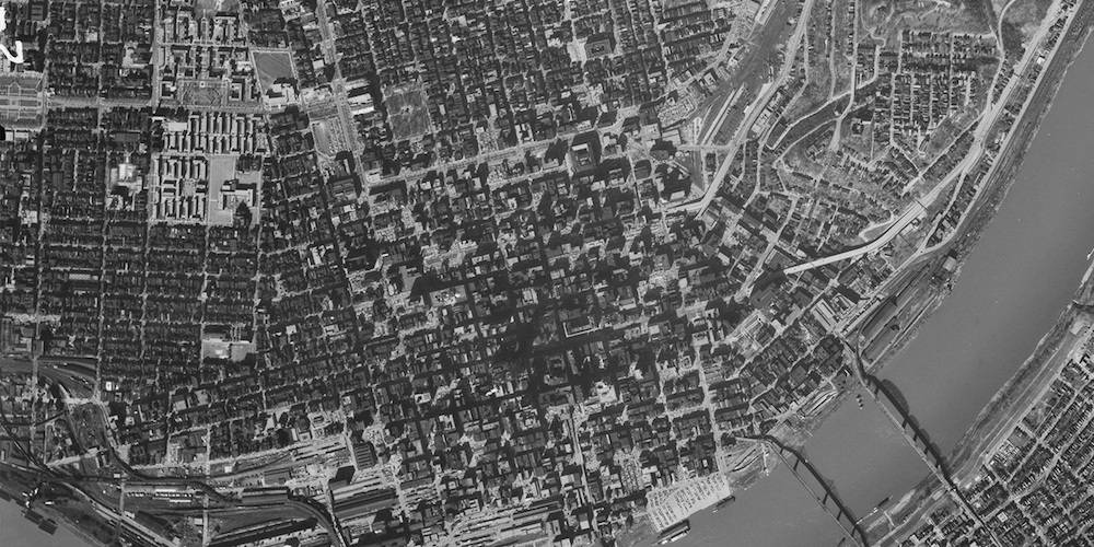
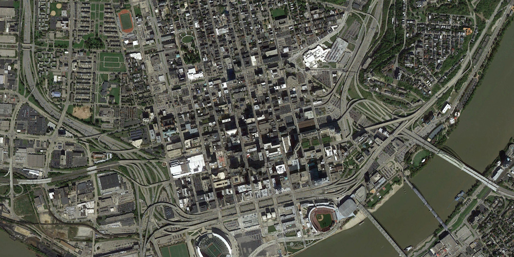


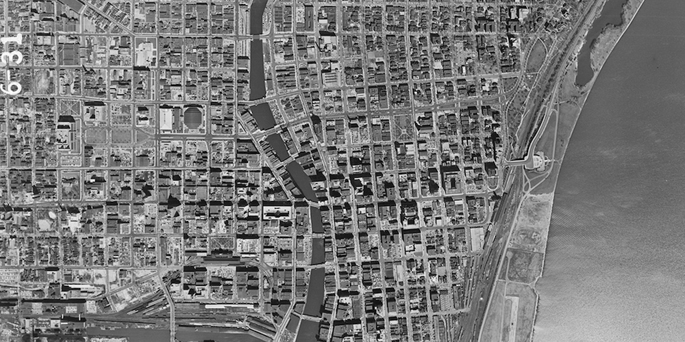


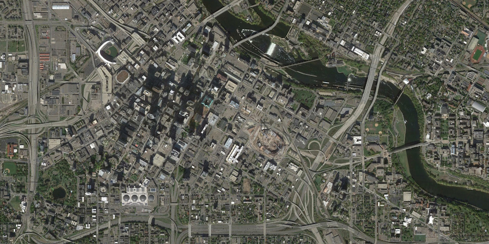
In the mid 20th century, much of this density was lost to make way for the car, a fact illustrated so well by these maps published by the University of Oklahoma’s Shane Hampton. He writes of the contrasting views:
60 years has made a big difference in the urban form of American cities. The most rapid change occurred during the mid-century urban renewal period that cleared large tracts of urban land for new highways, parking, and public facilities or housing projects. Fine-grained networks of streets and buildings on small lots were replaced with superblocks and megastructures. While the period did make way for impressive new projects in many cities, many of the scars are still unhealed.
Indeed, the pictures show cities eviscerated by highways. Semi-occupied lots fill the spaces where tightly packed housing once stood. Wide arterial roads replace narrow streets. It is a picture of sprawl.
What’s interesting is that many of the cities featured have experienced economic decline in the last 60 years. On the other hand, cities like San Francisco, Boston and New York City that did not undergo such profound transformations (not that people didn’t try), have remained economically vital.
As with many things, the answers to present and future problems can often be found in the past. The older pictures show that we know what to do, how to build and how to make cities vibrant, walkable and sustainable. If we can build that type of cities once, we can do it again…at least one can hope.
See more interactive maps on the University of Oklahoma’s Institute for Quality Communities website.
Hat tip to Lloyd